
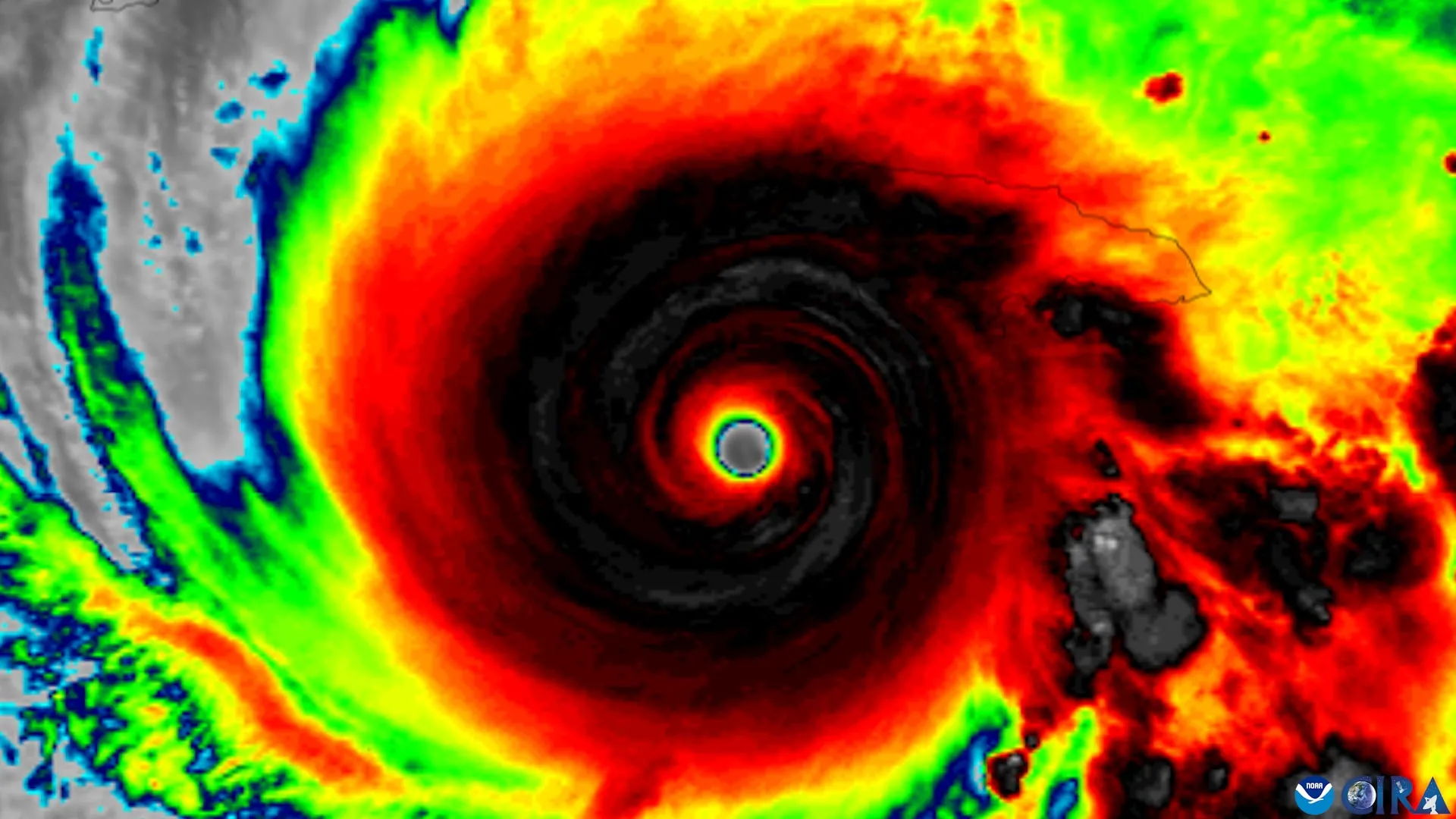
For decades, meteorologists have observed a recurring phenomenon in the Atlantic and Pacific: a tropical cyclone forms, struggles to maintain its composure, and eventually either dissipates or undergoes a rapid, terrifying transformation into a major hurricane. At the heart of this transition is a physical struggle for "vertical alignment." Much like a spinning top that loses its balance and wobbles, a tropical cyclone that is "tilted"—where its rotating centers at different altitudes are horizontally displaced—is physically inhibited from intensifying.
A landmark study, published in the Journal of Geophysical Research: Atmospheres, has now demystified this process. By analyzing nearly 30 years of data from NOAA’s legendary Hurricane Hunter aircraft, researchers have identified four specific "markers of alignment" that act as a harbinger for storm intensification. This discovery promises to grant coastal communities and emergency managers the one commodity they value most: time.
The Mechanics of a "Tilted" Storm
To understand why a hurricane intensifies, one must first understand its anatomy. A tropical cyclone is not merely a surface-level storm; it is a massive, three-dimensional engine fueled by the evaporation of warm ocean water. For this engine to reach maximum efficiency, its circulation—the column of rotating winds—must be vertically stacked.
"A tropical cyclone has to stand up straight before it can intensify," explains Michael S. Fischer, the study’s lead author and an assistant professor in the Department of Atmospheric Sciences at the University of Miami’s Rosenstiel School.
When a storm is subjected to "vertical wind shear"—a change in wind speed or direction with height—the top of the storm’s circulation is literally pushed away from its base at the ocean surface. This "tilt" acts as a structural bottleneck. As long as the centers are misaligned, the heat engine is disrupted, and the storm remains unable to concentrate the energy necessary to drop its central pressure and escalate its wind speeds.
Chronology of a Data-Driven Discovery
The path to this discovery was paved by the development of the Tropical Cyclone Radar Archive of Doppler Analyses with Recentering (TC-RADAR). This massive database, spearheaded by Fischer and his colleagues, represents the most comprehensive look at hurricane structure ever compiled.
The 1997–2024 Retrospective
The research team sifted through 1,510 radar analyses collected over 28 hurricane seasons. By utilizing data specifically gathered by NOAA’s specialized P-3 and Gulfstream IV aircraft, the researchers were able to create a historical "playback" of storm evolution.
- 1997–2010: The Era of Baseline Observation: Early data provided the framework for understanding how shear impacted storm structure, but technology lacked the resolution to track the "re-centering" process in real-time.
- 2011–2020: The Rise of TC-RADAR: As radar processing power grew, the team began aggregating flights into a singular, searchable archive. This allowed for the direct comparison of "aligned" versus "tilted" storms.
- 2021–2024: Synthesis and Conclusion: By applying advanced statistical modeling to the entire archive, the team identified that the signs of alignment weren’t just random; they were predictable, observable, and measurable precursors.
The Four Pillars of Alignment
The study identifies four critical criteria that, when met, serve as a "green light" for a storm to straighten its structure and begin its climb toward major hurricane status.
1. Compact, Surface-Level Circulation
The storm must possess a tightly wound, compact core near the ocean surface. A broad, disorganized low-pressure area lacks the structural integrity to fight off environmental wind shear.
2. Favorable Tilt Orientation
The orientation of the tilt relative to the direction of vertical wind shear is crucial. If the tilt is positioned in a way that allows the storm’s internal heat to be redistributed rather than stripped away, the cyclone has a much higher chance of "righting" itself.
3. Vigorous Updrafts and Deep Convection
The research highlights that thunderstorms near the lower-level center are not just symptoms of a storm—they are active participants. Intense rainfall and rising air near the center act as the "muscles" that help pull the leaning circulation back into an upright position.
4. Environmental Conduciveness
The "atmospheric neighborhood" must be supportive. This includes warm sea surface temperatures, high mid-level moisture, and relatively weak environmental wind shear. If the surroundings are too dry or the shear too aggressive, the storm remains tilted and stunted.
Supporting Data: The "Pre-Alignment" Signature
Perhaps the most striking finding from the TC-RADAR analysis is that storms that successfully align do not do so spontaneously. They show clear, identifiable physical traits up to 24 hours before the transition occurs.
"The storms that aligned already looked different about a day beforehand," Fischer noted. "They had stronger, more tightly wound circulations near the surface and more widespread, vigorous thunderstorms lifting air near that center."
This suggests that the atmosphere has a "memory" and a "momentum." If a storm displays these heightened levels of activity, it is effectively signaling that it is preparing to reorganize. This insight shifts the perspective of meteorologists: instead of viewing convection as a passive outcome of a storm’s strength, they can now view it as a diagnostic tool for future intensity.
Official Responses and Scientific Implications
The implications for NOAA and the National Hurricane Center (NHC) are profound. Currently, reconnaissance aircraft already collect data on wind strength, storm size, and tilt direction during their flights into the eye of a storm.
Bridging the Modeling Gap
One of the primary challenges in hurricane forecasting is "model bias." High-resolution models sometimes struggle to perfectly replicate the physics of a storm’s vertical realignment. By providing a clear set of observed physical requirements for alignment, the study gives modelers a "ground truth" to check their simulations against. If a model predicts a storm will stay tilted, but the observations show the four markers are present, forecasters can now adjust their confidence levels accordingly.
Enhancing Public Safety
For emergency managers, the "rapid intensification" (RI) of a storm is a worst-case scenario. RI events leave little time for the logistical nightmare of evacuations. By identifying the early-warning signs that a disorganized storm is on the verge of aligning and strengthening, meteorologists can provide officials with an extra 12 to 24 hours of decision-making space.
"Even a modest increase in forecast confidence a day earlier can provide more usable preparation time for communities in a storm’s path," says Fischer. In a hurricane, 24 hours is the difference between a boarded-up window and a finished evacuation.
Future Directions: Beyond the Archive
The study, co-authored by George R. Alvey III, Deelan Jariwala, and Paul D. Reasor, provides a robust framework that will likely influence operational meteorology for years to come.
Looking forward, the research team hopes to integrate these findings into real-time decision-support tools. By automating the detection of these four markers within the data streams coming directly from Hurricane Hunter aircraft, the transition from "tilted" to "aligned" could eventually be flagged automatically in the field.
As the scientific community continues to grapple with the impacts of a warming climate on tropical cyclone intensity, tools that help us read the "body language" of a storm become increasingly vital. The work of the Rosenstiel School team reminds us that while hurricanes are chaotic, they are ultimately governed by the rigid laws of fluid dynamics—and now, we are better equipped than ever to read the signs of their next move.
Funding and Acknowledgments: This research was supported by the National Science Foundation under award No. 2241605. The authors also acknowledge the invaluable contributions of the NOAA flight crews who, for decades, have flown directly into the teeth of these storms to collect the data that made this study possible.