
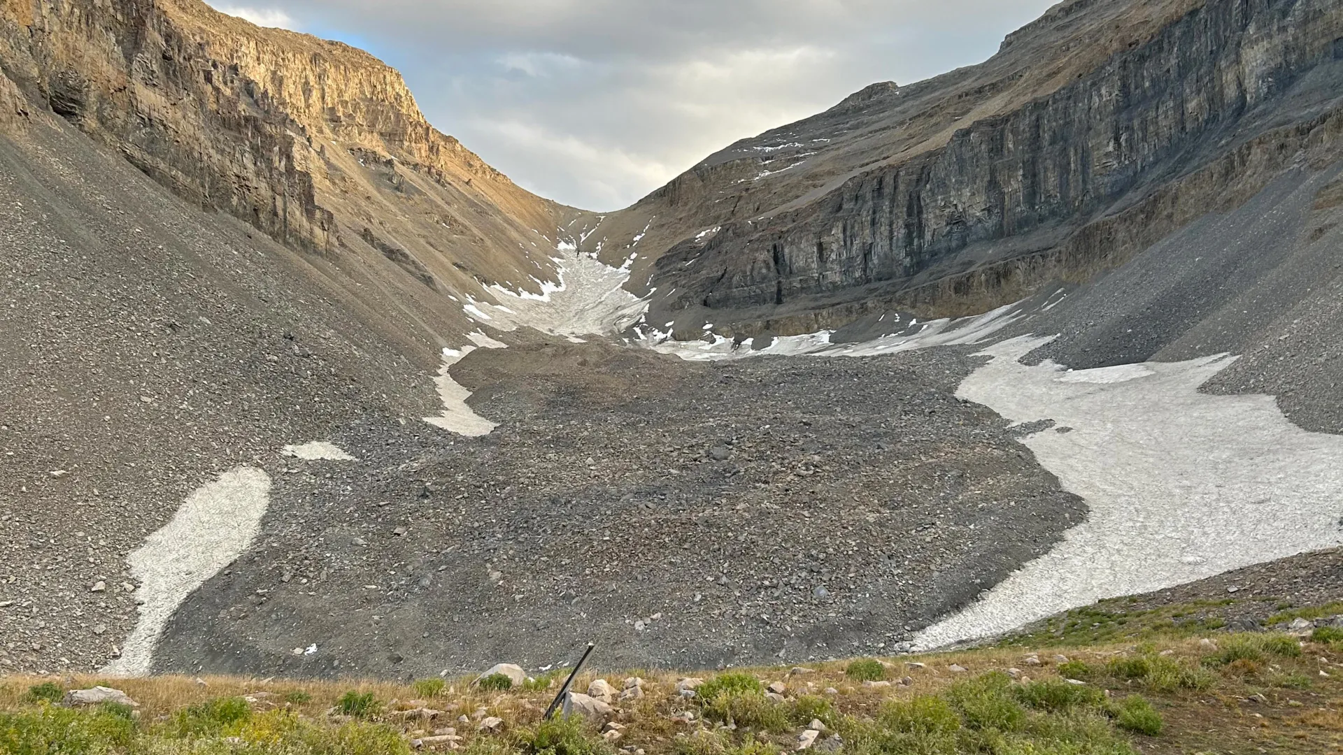
High in the craggy, sun-drenched peaks of Utah’s Wasatch and Uinta ranges, hikers often traverse what appears to be nothing more than an unremarkable field of loose rock and debris. These sprawling, boulder-strewn slopes are known to geologists as rock glaciers—landforms that, at first glance, lack the majestic, glistening blue ice of their traditional alpine counterparts. However, new research from the University of Utah suggests that beneath these deceptive, monochromatic exteriors lies a massive, hidden treasure of frozen water, fundamental to the state’s high-altitude hydrology.
In a groundbreaking pair of studies, researchers have effectively performed a "CT scan" on the Timpanogos Rock Glacier, located beneath the iconic summit of Mount Timpanogos. By employing advanced gravimetric technology and Bayesian statistical modeling, the team has not only quantified the immense volume of ice concealed within the mountain but has also fundamentally shifted our understanding of how these glacial features form and persist in a warming world.
The Invisible Giant: Quantifying the Timpanogos Ice
The Timpanogos Rock Glacier is far more than a pile of mountain debris. According to the recent findings published in the Journal of Geophysical Research, this singular feature contains approximately 1.5 million cubic meters of ice—a volume sufficient to fill 600 Olympic-sized swimming pools. To visualize the scale, lead researcher Bronson Cvijanovich, a former graduate student in the University of Utah’s Department of Geology & Geophysics, draws a striking comparison: the ice volume is roughly equivalent to the Great Pyramid of Giza.
Perhaps most surprising to the scientific community is the composition of the glacier. While it presents as a field of rock, the analysis reveals it is roughly 83% ice and only 17% loose stone. This high ice-to-rock ratio challenges the previous assumption that these landforms were merely surface-level debris fields with minor interstitial ice. Instead, they function as high-altitude, insulated ice boxes.
Chronology of Discovery: A Fall of Scientific Precision
The path to this discovery was paved during the fall of 2024, when Cvijanovich led a rigorous, multi-week field campaign to the slopes above Emerald Lake. The logistical challenge was significant; the team had to haul high-precision gravimetric equipment across the treacherous, unstable terrain of the rock glacier.
The methodology relied on a state-of-the-art gravimeter, an instrument sensitive enough to detect minute variations in the Earth’s gravitational pull. Because ice is significantly less dense than the surrounding bedrock, the glacier exerts a subtly weaker gravitational force than the solid mountain slopes. By establishing a dense grid of 232 measurement points—each spaced 25 meters apart—the team was able to map the gravitational signature of the entire feature.
Following the data collection, the researchers engaged in a Herculean task of digital reconstruction. They had to account for "noise" in the data—subtle gravitational fluctuations caused by the positions of the sun and moon, as well as the topographical irregularities of the mountain itself. Using Bayesian statistics, the team spent months of computational time to generate a 3D model of the internal ice, effectively peeling back the layers of rubble to reveal the frozen core.
Supporting Data: Understanding the Physics of Preservation
The second piece of the puzzle, published in Geophysical Research Letters on April 2, 2026, focused on the formation mechanism of these glaciers. Led by undergraduate researcher Isaiah Davies, this study addresses a long-standing question: How do these ice bodies persist without the high-altitude conditions usually required for traditional glaciers?
The research indicates that the rock glacier acts as a self-insulating system. As the steep headwalls of Mount Timpanogos erode, they shed constant debris onto the snow and ice patches below. This debris layer acts as a thermal blanket, protecting the underlying ice from solar radiation and ambient heat. The model suggests that rockfalls are not merely a byproduct of erosion but a vital component of the glacier’s life cycle, shielding the snow and allowing it to densify into ice over centuries.
Crucially, the study debunks the theory that these rock glaciers are relics of the last Ice Age, which reached its peak between 18,000 and 21,000 years ago. Instead, the evidence points to a more dynamic history, suggesting these formations are "living" reservoirs that developed in the millennia following the retreat of the major Pleistocene glaciers. They are not dying remnants of the past, but active features shaped by ongoing mountain processes.
Official Perspectives: The Experts Speak
The significance of these findings extends far beyond the borders of Utah. Professor Michael Thorne, a specialist in geophysics who oversaw the research, emphasizes the utility of the gravitational imaging technique.
"There is a large contrast in mass density between the rock that makes up Mount Timpanogos and the much lower density ice that is in the rock glacier adjacent to it," Thorne explained. "When we measure the gravitational acceleration over the rock glacier, we see a larger decrease in that gravitational acceleration as we make measurements over areas with thicker ice."
For glaciology professor Leif Anderson, the findings serve as a reminder of how much is happening beneath the surface of the natural world. "There’s a lot of ice that’s hidden in Utah’s mountains," Anderson remarked. "When we are high in the mountains and walking across loose rocks or rubble, you don’t realize there could be 120 feet of ice buried beneath your feet."
Implications: A Global Water Reservoir
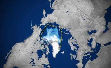
The broader implications of the Timpanogos study are staggering. Utah alone is home to 836 identified rock glaciers. By establishing a mathematical relationship between the surface area of these glaciers and their internal ice volume, the team was able to extrapolate their findings to a global scale.
The researchers estimate that the roughly 50,000 known rock glaciers worldwide could contain as much as 48 gigatons of water. To put that into perspective, one gigaton is equivalent to a cubic kilometer of water—enough to fill 400,000 Olympic swimming pools. In Utah alone, the total volume of water stored within these hidden rock-covered glaciers is estimated at one gigaton, or roughly 815,000 acre-feet.
This realization fundamentally changes how state water managers and climate scientists might view mountain water storage. As traditional snowpacks become less predictable due to shifting climate patterns, these rock-covered ice reserves may provide a more stable, albeit slower-releasing, source of water for alpine ecosystems and downstream users.
Conclusion: A New Frontier in Alpine Hydrology
The work conducted by the University of Utah team—supported by the U.S. Geological Survey, the National Science Foundation, and the Wilkes Center for Climate Science & Policy—represents a major leap forward in geophysics. By successfully utilizing Bayesian inversion of gravity data to visualize the internal structure of a rock glacier, researchers have unlocked a new way to monitor the "hidden" water of the American West.
As climate change continues to alter the high-altitude landscapes of the world, the humble rock glacier may prove to be one of the most critical, yet overlooked, components of the hydrological cycle. The ice beneath the rubble of Mount Timpanogos is no longer a mystery; it is a testament to the resilience of the mountain environment and a vital, frozen bank account for the future. The challenge for the next decade will be to better understand how these reservoirs respond to rising temperatures and whether their stored water can be sustainably accounted for in the face of increasing regional water scarcity.