
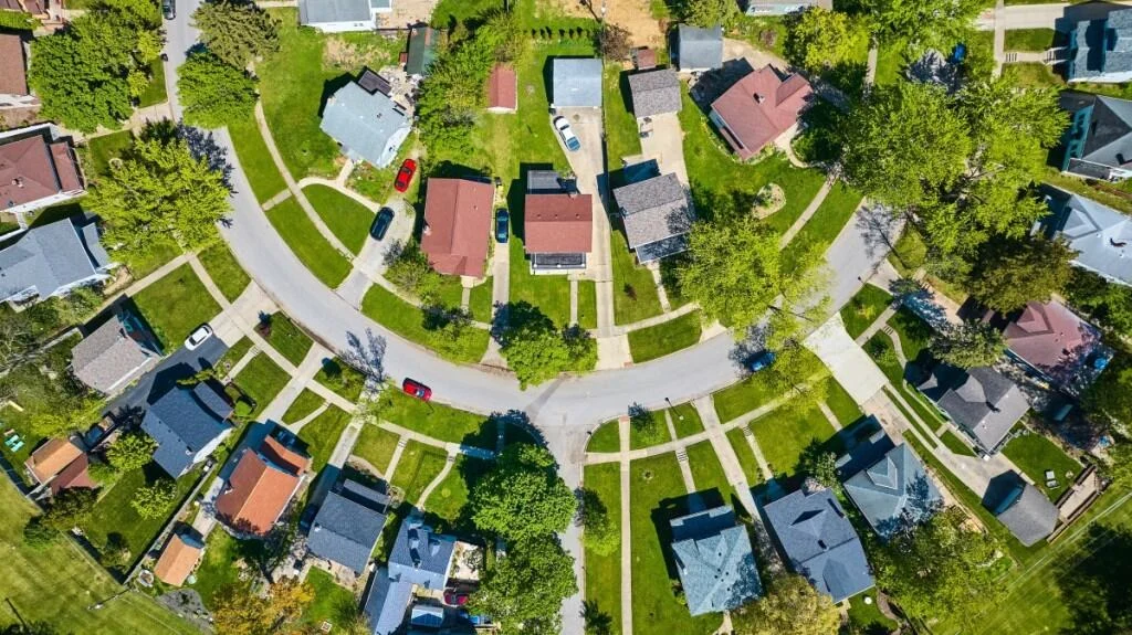
In the modern real estate market, first impressions are no longer made at the front door; they are made on a smartphone screen. As prospective buyers scroll through endless listings, static interior photos are increasingly being eclipsed by the cinematic allure of aerial cinematography. Drone photography has transformed from a niche luxury into a powerful, high-conversion marketing tool, capable of showcasing a property’s scale, landscaping, and proximity to neighborhood amenities in a way that traditional ground-level photography simply cannot match.
However, behind every sweeping, sun-drenched aerial shot of a colonial home in Cleveland or a sprawling ranch in Chattanooga lies a complex infrastructure of aviation law, safety logistics, and professional preparation. While homeowners do not need to become pilots themselves, understanding the “flight path” to a successful drone shoot is essential for any seller looking to maximize their property’s market appeal.
The Regulatory Landscape: Navigating FAA Part 107
The most critical factor in real estate drone photography is not the camera quality or the pilot’s artistic flair—it is the legal framework governing the sky. In the United States, all commercial drone operations are strictly regulated by the Federal Aviation Administration (FAA) under a set of rules known as "Part 107."
What is Part 107?
FAA Part 107 is the regulatory standard for Small Unmanned Aircraft Systems (sUAS). It requires any pilot flying for commercial purposes—such as capturing photos for a real estate listing—to hold a Remote Pilot Certificate. To obtain this, pilots must pass a rigorous aeronautical knowledge exam covering airspace classifications, weather patterns, emergency procedures, and federal regulations.
This certification is more than a badge of honor; it is a legal requirement. When you hire a photographer, you are essentially hiring an aviation professional. A Part 107 pilot is trained to identify risks, communicate with air traffic control when necessary, and ensure that the flight does not endanger people, property, or other aircraft.
The Myth of "Do It Yourself"
Some homeowners might be tempted to ask a friend with a hobbyist drone to snap a few photos. This is a significant mistake. Hobbyist drones are not subject to the same strict safety and insurance requirements as commercial units. Furthermore, operating a drone for a real estate sale without a Part 107 license is a violation of federal law, which can lead to severe fines and legal complications that could jeopardize your home sale.
Airspace Logistics: Why Your Location Matters
Not all sky is created equal. The FAA categorizes airspace into various classifications, and some zones are strictly off-limits to drones without special, pre-approved authorization.
Controlled vs. Uncontrolled Airspace
- Controlled Airspace (Class B, C, D, and Surface E): If your property is located near a major commercial airport (like LAX or JFK) or a medium-sized regional airport, you are likely in "controlled airspace." In these areas, drone pilots must request and receive authorization from the FAA before takeoff.
- Restricted Zones: Military installations, high-security government facilities, and even some sports stadiums may have "Temporary Flight Restrictions" (TFRs) or permanent no-fly zones.
As Benjamin Disinger, founder of Goodlook, explains, "You don’t need to contact local airports or airspace authorities yourself. That responsibility falls on the photographer, who should hold an FAA Part 107 certification. A licensed operator understands airspace restrictions near your property and captures strong angles safely without risking a collision with low-flying aircraft."
The "Wait Time" Factor
If your property is situated within controlled airspace, your photographer may need to secure an LAANC (Low Altitude Authorization and Notification Capability) authorization. While this is often an automated process, in more complex zones, it may require a formal waiver from the FAA. This is not a red flag; it is a sign of a professional doing their due diligence. Sellers should be prepared for the possibility that their shoot date may need to be adjusted to align with airspace clearance timelines.
Insurance and Liability: Protecting Your Assets
Drone photography, while generally safe, involves inherent risks. Mechanical malfunctions, unexpected wind gusts, or human error can result in accidents. A drone falling from the sky is not merely a nuisance; it represents a potential liability for property damage or physical injury.
Professional photographers carry commercial drone liability insurance specifically designed for this purpose. When vetting potential vendors, sellers should adopt a "trust but verify" approach:
- Ask for proof of Part 107 certification: Any reputable photographer will have this on hand.
- Verify liability coverage: Ask specifically about the coverage limits.
- Check for "Additional Insured" status: Some homeowners associations (HOAs) may require that the drone operator provide a certificate of insurance listing the property or the HOA as an additional insured party.
If a contractor hesitates when asked about insurance, this is a clear signal to move on. The peace of mind provided by a fully insured professional is a non-negotiable component of the listing process.
Chronology of a Successful Drone Shoot
To ensure your property is ready for its aerial close-up, follow this timeline:
- Phase 1: Research (3–4 weeks before listing): Contact a professional photographer. Provide them with your property address so they can check the airspace classification.
- Phase 2: Authorization (2 weeks before): If you are in controlled airspace, the photographer will begin the FAA filing process.
- Phase 3: Exterior Staging (1 week before): Begin the process of deep-cleaning the exterior of your home.
- Phase 4: Final Prep (24 hours before): Clear all clutter from the driveway and backyard.
- Phase 5: The Shoot Day: Ensure all pets are inside and that the property is clear of maintenance crews or cleaning staff.
Preparing the Property: The "Bird’s-Eye" Perspective
Most homeowners are experts at staging their interiors, but they often forget that a drone sees the property from a vantage point that is rarely viewed by humans.
The team at Realist Drone Services notes that the camera captures everything, often highlighting flaws that go unnoticed from the ground. "We’ve arrived at beautiful, photo-ready homes only to send the drone up and realize the backyard still had trash cans out, pool equipment everywhere, hoses stretched across the lawn, or cars filling the driveway," they explain.
Checklist for Aerial Readiness:
- Driveway Clarity: Move all vehicles to the garage or the street. An empty, clean driveway provides a clean aesthetic.
- Backyard Integrity: Store away pool skimmers, garden hoses, trash bins, and children’s play equipment.
- Landscaping: A freshly mowed lawn is the single most effective way to improve aerial curb appeal. Consider adding a layer of mulch or trimming overgrown shrubs.
- Roof and Gutters: Because the drone will likely fly above the home, ensure your roof is free of debris and that gutters are clean.
- Outdoor Furniture: Arrange patio furniture symmetrically. If you have an umbrella, ensure it is either fully open or fully closed—half-measures look messy from the air.
The Strategic Value of Aerial Marketing
The implications of high-quality drone photography extend far beyond aesthetic appeal. Data consistently shows that listings with professional, high-quality media receive significantly more views, shares, and inquiries than those without.
Why It Matters
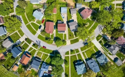
- Contextual Awareness: Buyers want to know what the neighborhood looks like. Is there a park nearby? How close is the school? Is the home on a quiet cul-de-sac or a busy thoroughfare? Drone footage answers these questions instantly.
- Scale and Scope: For properties with large acreage, pools, or extensive gardens, ground photography cannot capture the full extent of the asset.
- Competitive Edge: In a crowded market, your listing is competing against dozens of others. A professional, cinematic drone video can be the deciding factor that pushes a buyer to schedule a physical tour.
Conclusion: The Sky is the Limit
Drone photography is a sophisticated tool that, when wielded by a professional, offers an unparalleled look at a property’s potential. By prioritizing legal compliance—specifically Part 107 certification and FAA authorization—and focusing on the exterior details that only a bird’s-eye view can reveal, you ensure that your home stands out in the most crowded of markets.
Do not wait until the last minute to engage with a drone photographer. Treat the aerial shoot as a vital part of your home’s marketing strategy, equal in importance to the home inspection or the final staging. With the right preparation, you aren’t just selling a house; you are offering a vision of a lifestyle that begins long before the buyer even steps through the front door.