
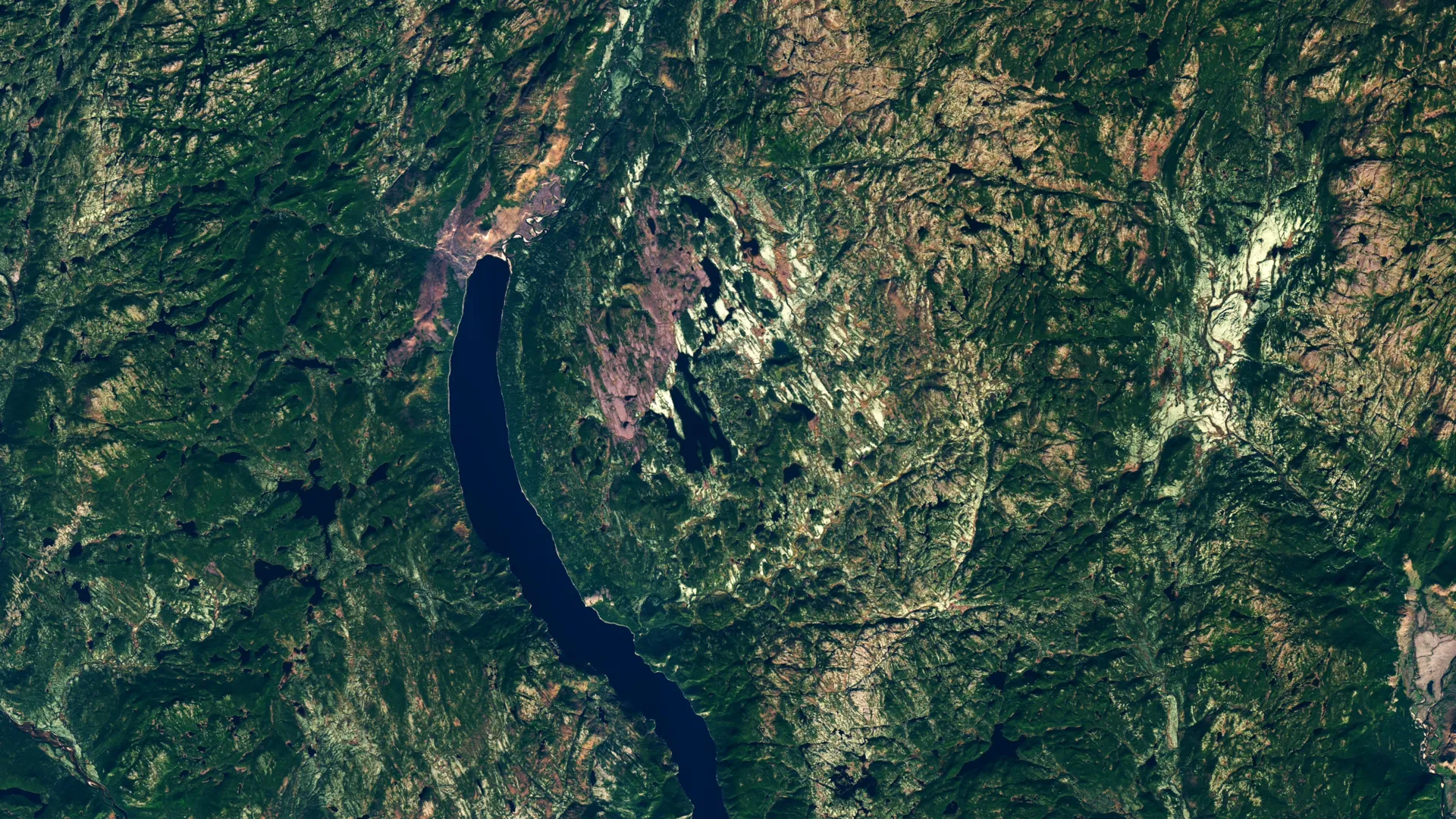
In the vast, untamed wilderness of Quebec’s Côte-Nord region, a geological titan has been sleeping for nearly 400 million years. Hidden beneath dense boreal forest and rugged, swampy terrain, the site remained invisible to the modern world until a serendipitous encounter between an amateur astronomer and a digital satellite map. What was intended to be a simple search for a serene camping location has resulted in one of the most significant geological finds of the decade: the confirmation of the Uhackatik impact crater, a 25-kilometer-wide scar on the Earth’s surface.
This discovery not only adds a new chapter to Canada’s geological history but underscores the invaluable role of citizen science in an era where high-resolution satellite imagery has turned the entire planet into an open-access laboratory.
The Chronology of a Discovery: From Pixels to Paleogeology
The story of Uhackatik began in 2024, when Joël Lapointe, an amateur astronomer with a keen eye for celestial mechanics, began scouting the remote reaches of Quebec for a remote getaway. While navigating online satellite imagery, a peculiar, near-perfect circular depression near Lake Marsal caught his attention.
To the untrained eye, the region might appear as typical Canadian shield landscape. However, Lapointe’s background in astronomy allowed him to recognize the structural hallmarks often associated with high-velocity impacts. Instead of dismissing the anomaly, he reached out to experts in both North America and Europe. His inquiry acted as the catalyst for a chain of events that would eventually bring the scientific community to this isolated pocket of the wilderness.
By the time the Meteoritical Society convened for their 2024 annual meeting, a group of French researchers had already analyzed the area, presenting the Lake Marsal site as a potential 11th confirmed impact structure in Quebec. The data caught the attention of Dr. Gordon Osinski, a preeminent planetary geologist at Western University and the director of the Impact Earth database. While initially skeptical—as many circular geological features are later debunked as volcanic or glacial in origin—Osinski recognized the legitimacy of the request. He began planning a logistical operation that would take over a year to manifest: an expedition into the heart of the Côte-Nord.
A Gauntlet of Wilderness: The October 2025 Expedition
Reaching the site proved to be an exercise in endurance. In October 2025, Dr. Osinski and his research team deployed to the site, facing the harsh realities of the Quebec backcountry. The mission was a logistical challenge from the outset; unable to land directly on the shore, the team was forced to navigate the final 50 meters (165 feet) of water on foot, hauling heavy equipment through frigid, murky depths.
Once on land, the struggle only intensified. The area was characterized by what Osinski described as "deep, twisty, gnarly vegetation," a dense, swampy thicket that hampered movement and visibility. Despite his extensive field experience across six continents, Osinski remarked that the Uhackatik site ranked among the most difficult environments he had ever traversed.
For the first day, the team found little to definitively prove the site’s origin. Previous geological surveys of the area had categorized the local breccia—a rock composed of broken fragments of minerals or rock cemented together—as evidence of a "diatreme." A diatreme is a volcanic pipe formed by a gaseous explosion, which creates a funnel-shaped structure often mimicking the appearance of an impact crater. The team faced the prospect that they were chasing a geological phantom.
The Turning Point: Shatter Cones and Scientific Confirmation
The breakthrough occurred on the second day of the expedition. As the team combed through the rock outcrops, they discovered "shatter cones." These are rare, cone-shaped rock fractures that radiate from a central point, created only by the extreme, instantaneous shock waves generated by a high-velocity meteorite impact.
"It’s the only unequivocal evidence of an impact event that you can see in the field with the naked eye," Osinski explained. The presence of these cones shattered the volcanic theory, providing the "smoking gun" the team needed.
The data revealed a complex crater structure approximately 25 kilometers (16 miles) in diameter. The site features a central uplift—a characteristic rebound effect seen in large impacts where the center of the crater rises after the initial collision—and dramatic, high cliffs displaying columnar jointing.
Based on the surrounding strata and initial dating of the rock samples, the impact occurred roughly 390 million years ago. This places the event in the Devonian Period, a time of significant evolutionary change on Earth. The collision would have been a cataclysmic event, capable of regional annihilation and significant shifts in local climate patterns.
Supporting Data: Why Uhackatik Matters
The confirmation of the Uhackatik crater provides critical data for researchers studying Earth’s bombardment history. The date—390 million years ago—is particularly intriguing because it sits roughly 100 million years before a known, statistically significant spike in cratering on both Earth and the Moon. Scientists have long debated whether this uptick was caused by massive collisions within the asteroid belt that sent debris raining down on the inner planets.
In collaboration with the Innu Council of Ekuanitshit, the researchers have officially named the site "Uhackatik." The process of naming the crater in consultation with Indigenous partners highlights a growing trend in geology to integrate traditional knowledge and local cultural recognition into the scientific process.
While the Meteoritical Society has yet to issue its formal, final stamp of approval, the scientific consensus among the field team is near absolute. When confirmed, Uhackatik will be the largest impact structure discovered since the 31-kilometer Hiawatha crater was identified in 2018.
The Limitations of Accessibility
Despite its geological grandeur, Uhackatik is unlikely to serve as a training ground for the next generation of space explorers. Dr. Osinski, who serves as a key member of NASA’s Artemis Geology Team, has spent his career preparing astronauts to identify geological features on the Moon and Mars. However, he noted that the sheer remoteness and environmental hazards of the Quebec site make it impractical for training.
"We have other sites, such as the Kameshtashtan (Mistastin Lake) crater in Labrador, which are much more accessible and offer similar geological insights for our astronauts," Osinski noted. The Labrador site has historically been used for training, providing a safer, more sustainable environment for complex field simulations.
Implications for the Future: The Power of Citizen Science
The discovery of Uhackatik is a testament to the democratization of science. For Joël Lapointe, the journey from an amateur’s curiosity to a scientific breakthrough has been transformative. In interviews with local media, he expressed his excitement, noting that he was "over the Moon" to learn that his intuition was correct.
"I encourage everyone to not ignore intuition or an observation, even if it isn’t part of your field of expertise," Lapointe said.
This sentiment is echoed by space agencies worldwide. NASA and other international organizations have aggressively expanded their citizen science programs, recognizing that the sheer volume of data produced by modern satellites and telescopes exceeds the capacity of professional researchers alone.
Programs like the Daily Minor Planet project invite the public to scan for near-Earth asteroids, while the Impact Flash project encourages volunteers to monitor the lunar surface for the tell-tale light of meteoroid strikes. Even the Exoasteroids project, which searches for evidence of debris disks around distant stars, has opened the floor to public participation.
The Uhackatik discovery serves as a reminder that the age of discovery is far from over. Beneath the canopy of the world’s forests and the shifting sands of its deserts, thousands of secrets remain hidden. With high-resolution mapping tools in the hands of the public, the next major scientific revelation may not come from a multi-billion dollar telescope, but from a curious individual sitting at a kitchen table, looking at the world from a different perspective.
As geologists continue to catalog the Earth’s hidden history, the Uhackatik crater stands as a monument to the intersection of human curiosity, advanced technology, and the raw, violent power of the cosmos. For now, the site will remain a quiet, protected landmark—a 390-million-year-old reminder of our planet’s place in a dynamic and often volatile solar system.