
The American West is currently confronting a hydrological crisis of unprecedented proportions. In 2026, the Colorado River Basin—the lifeblood of the southwestern United States—entered a state of systemic failure, driven by a catastrophic "snow drought" and persistent, record-breaking temperatures. As the primary reservoirs that sustain the region, Lake Powell and Lake Mead, plummeted to historic lows, the fragility of the 20th-century water management infrastructure has been laid bare, threatening the livelihoods of 40 million people and the stability of 5 million acres of vital agricultural land.
The Anatomy of a Crisis: Main Facts and Current Realities
The Colorado River system serves as a complex, interconnected plumbing network for the Southwest. It provides the essential water supply for major metropolitan centers, including Las Vegas, Phoenix, Los Angeles, and San Diego, while simultaneously fueling a massive agricultural sector. However, the system is fundamentally dependent on high-elevation winter snowpack, which acts as a natural storage mechanism, releasing water gradually throughout the spring and summer.
The 2025–2026 winter season failed to deliver that essential bounty. A combination of insufficient precipitation and anomalous heat waves resulted in a rapid evaporation of moisture, leaving the mountains of the Upper Colorado Basin largely barren. By the peak of the 2026 summer, the ripple effects of this deficiency reached the reservoirs. Lake Powell, the nation’s second-largest reservoir, fell to its lowest point since it began filling in the 1960s, signaling a breakdown in the water security of the entire river system.
Chronology of a Collapse: A Timeline of 2026
The deterioration of the basin was not an overnight occurrence, but rather the result of a compounding series of environmental failures throughout the year:
- Winter 2025–2026: The Upper Colorado Basin experiences a severe snow drought. Temperatures remain consistently above historical averages, preventing the accumulation of the necessary "snow water equivalent" required to sustain the river during the dry months.
- April 2026: Recognizing the impending crisis, the U.S. Bureau of Reclamation (USBR) shifts into emergency mode. The agency initiates operational changes at Glen Canyon Dam to stabilize Lake Powell and preserve its ability to generate hydroelectric power, a move that signals the gravity of the situation to state water managers.
- May–July 2026: As spring temperatures soar, the anticipated "pulse" of snowmelt fails to materialize. Inflows into Lake Powell remain at a fraction of their historical norms.
- August 2026: The situation reaches a critical threshold. Lake Powell falls below its previous record low of 3,519.92 feet, set in April 2023. Simultaneously, downstream, Lake Mead hits its own record-low levels, forcing federal officials to drastically restrict outflows.
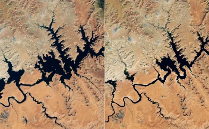
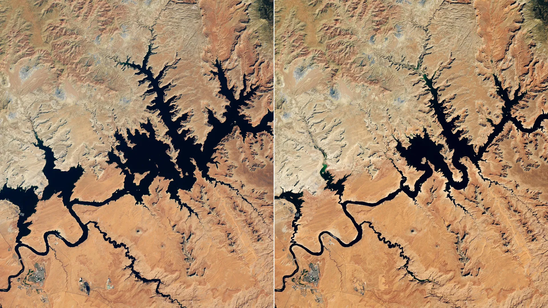
- September 1, 2026: Satellite imagery from NASA-USGS Landsat 8 provides a sobering visual record. Compared to the relative abundance of 2017, the 2026 landscape is defined by vast, exposed "bathtub rings"—massive white deposits on the canyon walls marking the lost water line.
- September 10, 2026: Lake Powell reaches a nadir of 3,517.24 feet. The reservoir is no longer just a water bank; it is a symbol of a regional climate system that is fundamentally changing.
Supporting Data: The Evidence of a Megadrought
The 2026 disaster must be viewed through the lens of the "megadrought," a period of prolonged aridification that has gripped the Southwest since the turn of the 21st century. This is not merely a dry spell; it is a long-term shift in the regional climate regime.
The USBR, in conjunction with NASA-supported monitoring projects, has been utilizing the Western Land Data Assimilation System (WLDAS) to provide real-time visualizations of soil moisture and evapotranspiration. The data is stark: the soil is so parched that it absorbs a significant portion of the meager snowmelt before it can ever reach the river channels. This "thirsty soil" phenomenon, exacerbated by higher ambient temperatures, has effectively broken the traditional correlation between snowpack levels and reservoir inflows.
Furthermore, the Colorado River Integrated Assessment tool, developed by Arizona State University and the Central Arizona Project, has integrated satellite-validated measurements to provide a holistic view of the basin. The modeling shows that even with minor precipitation events, the cumulative deficit in surface and groundwater storage is so large that it would require multiple consecutive "above-average" winter seasons just to restore the system to a precarious stability.
Official Responses and Tactical Interventions
The U.S. Bureau of Reclamation, tasked with the impossible job of managing a dwindling resource, has been forced to make increasingly difficult trade-offs.
In a desperate bid to keep the turbines spinning at Glen Canyon Dam—the dam that creates Lake Powell—the USBR implemented emergency water releases from Flaming Gorge Reservoir in northern Utah and southern Wyoming. By moving water from upstream storage into the main stem of the river, the agency hoped to bolster levels at Powell.
However, these actions have come at a heavy cost. To preserve the water currently in the system, the USBR was forced to cancel vital environmental initiatives. The "controlled flood" of April 2026, designed to restore sandbars and fish habitats, was scrapped. Later in the summer, the agency also canceled "cool mix" releases, which are essential for protecting native fish species from the high temperatures of the river’s upper reaches. These decisions highlight the grim reality: when water is scarce, the needs of human consumption and power generation invariably supersede the needs of the natural ecosystem.
Implications for the Future: A Paradigm Shift
The events of 2026 have profound implications for the future of the American West. The current model of water allocation, rooted in agreements made nearly a century ago, is increasingly incompatible with the hydrological realities of the 21st century.
1. The Power Generation Crisis
The primary fear of federal managers in 2026 was that Lake Powell would drop to a level where the intake towers could no longer draw water through the hydroelectric turbines. While intervention prevented this "dead pool" scenario in 2026, the risk remains a constant specter. If hydropower generation fails, the regional power grid will face significant instability, necessitating expensive and potentially carbon-intensive alternatives to replace the lost renewable energy.
2. Tribal Sovereignty and Water Justice
The crisis has underscored the importance of tools like the Drought Severity Evaluation Tool, co-developed with the Navajo Nation. As the drought intensifies, the voice of Indigenous nations in water policy is becoming increasingly central. These communities, often the most vulnerable to water insecurity, are now at the forefront of data-driven drought monitoring, ensuring that their specific needs and land-management practices are considered in federal decision-making.
3. The Agricultural Reckoning
With 5 million acres of farmland dependent on the river, the agricultural sector faces a potential restructuring. The lack of reliable water in 2026 has already forced some growers to fallow land or shift away from water-intensive crops like alfalfa. This shift will ripple through the economy, affecting food prices and the economic viability of rural communities throughout the Southwest.
4. Policy and Technological Adaptation
The reliance on satellite data—from the Landsat series to specialized evapotranspiration models—is no longer a luxury; it is a necessity for survival. Decision-makers now have a level of granular information that was unimaginable even a decade ago. The challenge moving forward is not the lack of data, but the lack of political consensus on how to use it to implement mandatory, basin-wide conservation.
Conclusion
The 2026 Colorado River crisis serves as a definitive warning. The era of assuming that the river would provide a predictable, reliable flow is over. As the megadrought continues to strain the limits of the Southwest’s resources, the region finds itself in a race against time—not just to manage water, but to rethink the relationship between a growing population and a shrinking river. The satellite images of a depleted Lake Powell are more than just pictures of a lake; they are the mirror of a region facing an uncertain, thirsty future.