
Introduction: The Unpredictable Giant
Situated in the treacherous waters of the Sunda Strait, between the bustling islands of Java and Sumatra, Anak Krakatau—the "Child of Krakatoa"—has long served as a visceral reminder of the volatile tectonic forces shaping the Indonesian archipelago. In early September 2026, this small but perpetually restless volcanic island reclaimed the world’s attention. A sustained, high-intensity explosive eruption triggered a regional crisis, paralyzing air travel, degrading urban air quality, and forcing a massive coordination effort from humanitarian agencies.
For over 24 hours, the volcano unleashed a torrent of gas and ash into the stratosphere, an event that serves as a sobering case study in the intersection of natural hazards and modern infrastructure. While the eruption eventually subsided into a more rhythmic pattern, the event left an indelible mark on Indonesia’s aviation sector and public health discourse.
Chronology of the September 2026 Eruption
The Opening Salvo (September 5, 2026)
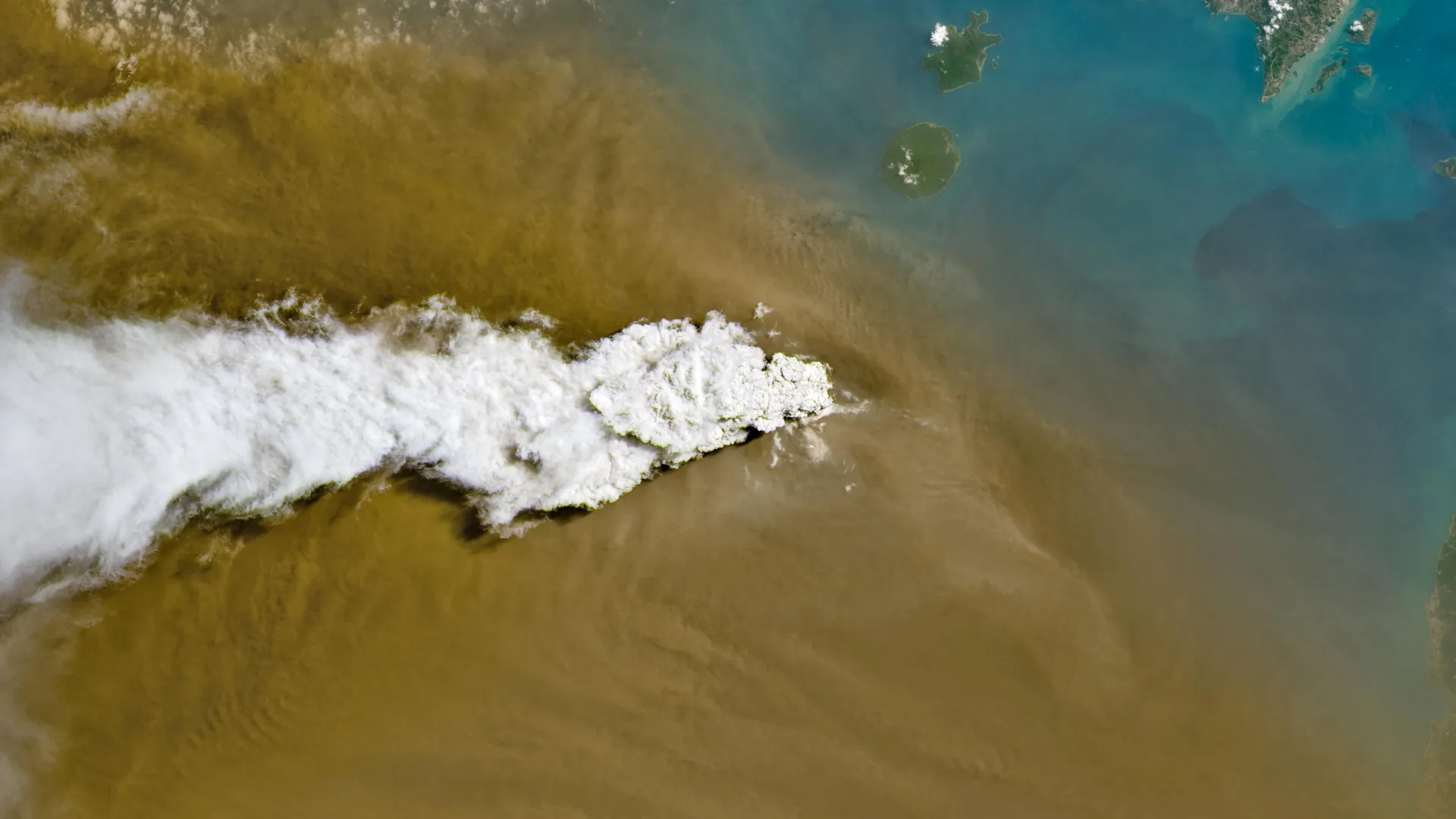
The intensification began in the early hours of September 5. Following months of elevated seismicity, the volcano transitioned from mild effusive activity into a violent, sustained explosive phase. By midday, satellite sensors were already capturing the sheer scale of the output. NASA’s Landsat 8, utilizing its Operational Land Imager (OLI), provided the first high-resolution glimpse of the disaster: a brilliant, piercing white plume of volcanic gas shooting vertically, contrasted sharply against a dense, suffocating cloud of dark brown ash.
As the day progressed, the Suomi NPP satellite, equipped with the Visible Infrared Imaging Radiometer Suite (VIIRS), provided a broader perspective. The imagery revealed a terrifying dispersal pattern, with volcanic material spreading horizontally across the Sunda Strait, effectively creating a "no-fly" blanket over one of the world’s most densely populated regions.
The Peak of Atmospheric Injection (September 6, 2026)
By the morning of September 6, the situation reached its apex. Indonesia’s meteorological agency, the BMKG (Badan Meteorologi, Klimatologi, dan Geofisika), issued urgent warnings as the ash column reached catastrophic altitudes. To the east of the vent, ash clouds were measured at 6,000 meters (20,000 feet), while the western drift saw an even more aggressive vertical injection, with plumes climbing as high as 15,000 meters (50,000 feet). At these altitudes, the ash enters the cruise levels of commercial aviation, posing a severe risk of engine failure due to the melting and ingestion of volcanic glass.
Transition to Strombolian Activity (September 6–7, 2026)
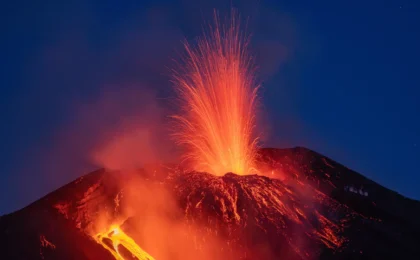
By the afternoon of September 6, the relentless, high-pressure output began to wane. The volcano shifted from a continuous explosive column to a series of periodic bursts known as "Strombolian eruptions." These events, characterized by the rhythmic ejection of incandescent cinder and lapilli, signaled a slight decompression of the conduit. While the immediate threat of a massive, sustained ash column decreased, the volcano remained in a state of high volatility.
Supporting Data: Satellites and Seismology
The 2026 eruption was perhaps the most well-documented in the island’s history, thanks to the synergy of orbital observation and ground-based monitoring.
Remote Sensing Insights
Data provided by NASA Earth Observatory highlighted the complexity of the eruption’s composition. The OLI sensors showed that the plume was not merely a singular block of smoke, but a stratified mixture of superheated gases—largely water vapor and sulfur dioxide—and pulverized rock. The VIIRS imagery proved critical for aviation authorities, allowing them to map the "ash density contours" in real-time, which dictated the closure of flight corridors.
The Warning Scale
It is important to note that Anak Krakatau has been living on borrowed time since July 2026, when it was placed on the second-highest alert level. This level mandates a strict exclusion zone, usually encompassing several kilometers around the crater. The September event was the manifestation of a long-term buildup of pressure within the magma chamber, a process that geologists have been tracking through ground deformation sensors and acoustic monitoring arrays.
Official Responses and Aviation Crisis
The immediate consequence of the ash dispersion was the effective grounding of the Indonesian sky.
The Airport Shutdown
On September 6, authorities confirmed the closure of eight airports across Java and Sumatra. The decision was not taken lightly; the ingestion of volcanic ash can cause total engine failure in jet aircraft, a risk that necessitated an immediate "stop-fly" order for all commercial and private traffic in the affected zones.
Nearly 3,000 flights were cancelled or diverted, affecting major hubs including Jakarta. The logistical chaos was immense, as thousands of passengers were stranded, and supply chains dependent on air freight were disrupted. It was not until September 8—nearly 72 hours after the initial surge—that the skies were deemed clear enough for commercial operations to resume.
Humanitarian Coordination
The Indonesian Humanitarian Coordination Platform (IHCP) played a pivotal role in disseminating information. Recognizing that the ash was settling over heavily populated urban centers, including the sprawling capital of Jakarta, the IHCP issued guidelines on how to manage the "ashfall."
One of the most complex challenges was distinguishing the health hazards of the volcanic ash from the concurrent smoke resulting from peatland fires elsewhere in Indonesia. The IHCP emphasized that while both are harmful, their properties differ:
- Volcanic Ash: Composed of abrasive, sharp-edged rock particles that can cause severe respiratory, skin, and ocular irritation.
- Peatland Smoke: Primarily a chemical/particulate haze that requires different filtration and mitigation strategies.
The agency warned residents to use N95-grade masks and to keep doors and windows sealed, particularly for those with pre-existing respiratory conditions like asthma.
Implications: A Vulnerable Infrastructure
The Anak Krakatau event of 2026 highlights the vulnerability of the modern, hyper-connected Southeast Asian region to volcanic activity.
Economic and Health Consequences
The economic cost of the two-day shutdown is still being calculated, but experts suggest it reaches well into the millions of dollars in lost productivity, fuel costs, and passenger compensation. Beyond the balance sheet, there is a lingering concern about the long-term impact of volcanic particulate matter on the health of millions in West Java. While the air eventually cleared, the deposition of ash into water sources and onto food crops remains a secondary concern that local governments continue to monitor.
Future Preparedness
The "high alert" status that has persisted since July suggests that Anak Krakatau is currently in a state of chronic instability. This indicates that the September event was likely not a "one-off" catastrophe, but part of a larger, ongoing cycle. For Indonesia, the challenge lies in maintaining this high level of vigilance without inducing "alarm fatigue" among the populace.
The collaboration between international bodies—such as NASA and the USGS—and local Indonesian agencies has been hailed as a model for disaster response. The use of real-time satellite data to inform ground-level decision-making saved countless lives and potentially prevented a major aviation disaster.
Conclusion: Living with the Volcano
As the smoke clears, the residents of the Sunda Strait are reminded of the inherent tension of living in the Ring of Fire. Anak Krakatau is not merely a mountain; it is a dynamic, living system that dictates the pace of life for those in its shadow. The 2026 eruption serves as a poignant reminder that despite our technological advancements in satellite tracking and rapid communication, nature retains the ultimate veto power over human infrastructure. As long as the "Child of Krakatoa" continues its volatile dance, preparedness, data-sharing, and rapid institutional response will remain the cornerstones of Indonesian survival and resilience.
Data Credits: NASA Earth Observatory images by Michala Garrison, using Landsat data from the U.S. Geological Survey, and VIIRS data from NASA EOSDIS LANCE, GIBS/Worldview, and the Suomi National Polar-orbiting Partnership.