
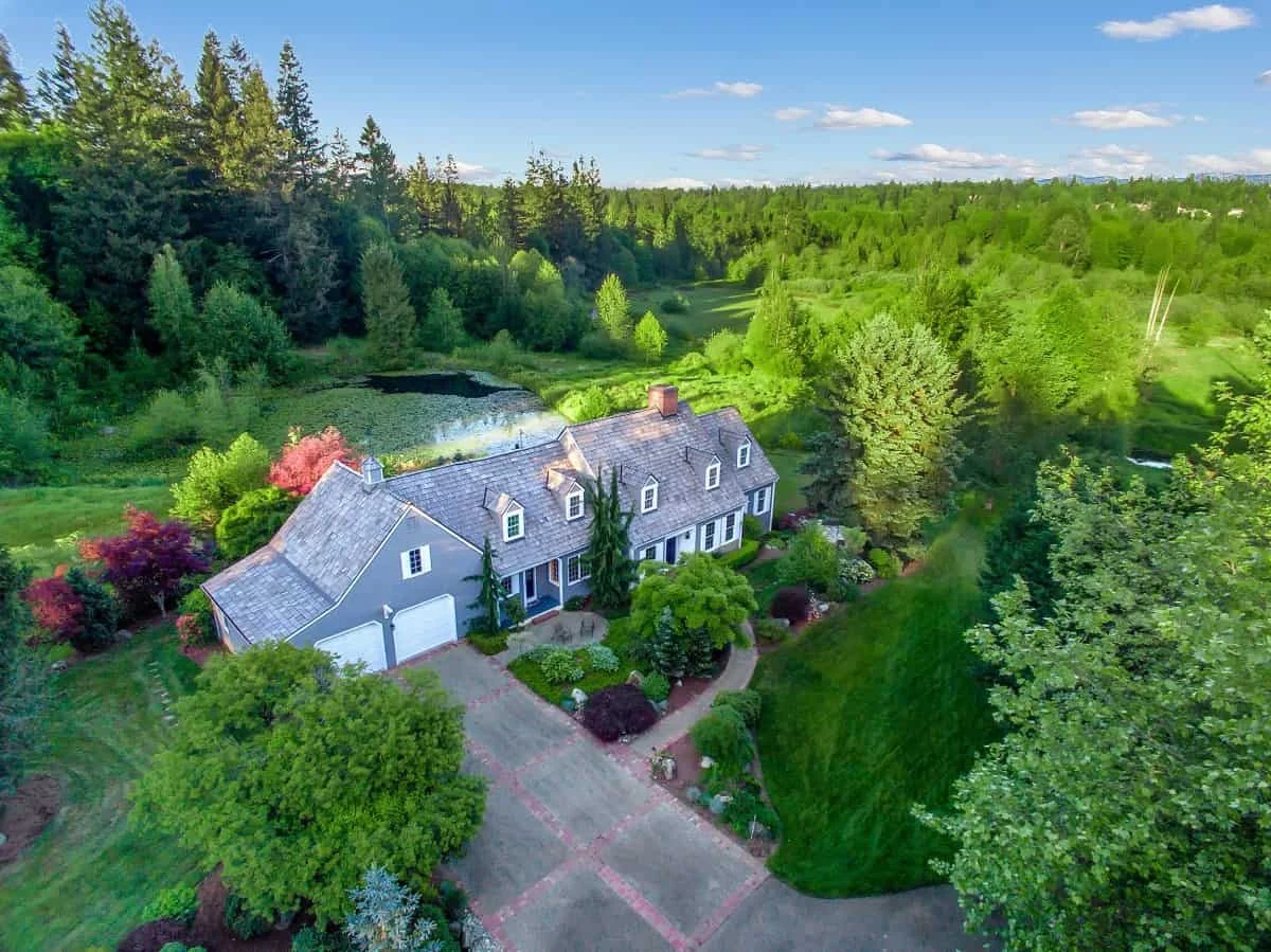
In the modern real estate market, the first showing no longer occurs at the front door; it happens on a smartphone screen, often from hundreds of feet in the air. As aerial photography becomes a standard expectation for premium listings, homeowners must shift their perspective. Preparing a property for a drone shoot requires a fundamental change in how one evaluates "curb appeal." While traditional staging focuses on the entryway and landscaping, drone photography demands a bird’s-eye view of the entire property—a perspective that reveals everything from roof condition to backyard logistics.
To successfully market a home in today’s digital-first environment, sellers must curate the visual narrative of their property from the sky down.
The Shift in Perspective: Why Aerial Imagery Changes the Game
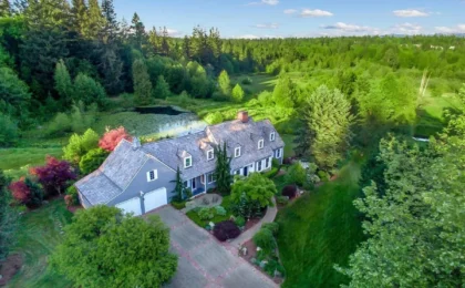
Drone photography fundamentally alters the hierarchy of a home’s features. From the sidewalk, a buyer’s gaze is naturally drawn to the front door, the color of the shutters, and the tidiness of the flowerbeds. However, from an altitude of 150 to 200 feet, the entire property is transformed into a single, cohesive map. The roof becomes a massive, unavoidable canvas; the driveway acts as a visual runway; and the small, overlooked habits of daily life—a stray garden hose, a recycling bin, or a stack of firewood—become glaring focal points.
The primary value of a drone shoot lies in its ability to provide context. A well-executed aerial shot captures the scale of a lot, the seclusion of a backyard, the proximity to nearby trails or water, and the architectural layout of the home in one frame. It is the ultimate tool for demonstrating the "lifestyle" value of a property. Yet, this high-definition transparency is a double-edged sword: it highlights exactly what you forgot to hide. Whether you are selling a sprawling ranch in Houston or a historic property in Atlanta, the objective is not to sterilize the home, but to eliminate "visual noise" that distracts potential buyers from the property’s true potential.
The Roof: The Largest Canvas in the Frame
For decades, real estate sellers have focused their exterior efforts on ground-level aesthetics. Drone imagery changes that calculus entirely. According to Haye Kesteloo, Founder and Editor-in-Chief of DroneXL, the roof must be treated with the same level of care as a manicured lawn.
Maintenance and Preparation
"From 150 feet up, your roof is the biggest surface in the frame, not your front door," Kesteloo notes. "Treat it like the lawn: clear the gutters, blow off leaves and pine needles, and remove moss streaks, tarps, or dead satellite dishes before the shoot."
The preparation should begin days before the scheduled flight. Homeowners should conduct an honest inspection of the roofline from the ground. While it is not necessary to hide genuine structural defects—which will inevitably be discovered during the formal home inspection process—removing debris is essential. A clean roof signals a well-maintained home, whereas a roof covered in detritus suggests deferred maintenance.
Professional Cleaning vs. DIY
If your roof is suffering from algae streaks or moss, consider professional intervention. However, caution is required. Asphalt shingles can be severely damaged by aggressive, high-pressure washing. Homeowners should seek out contractors who specialize in "soft-wash" methods, which use eco-friendly cleaning solutions to lift stains without damaging the roofing material. By addressing these issues before the photographer arrives, you ensure the aerial images reflect a property that has been cared for, rather than one that is hiding its age.
Looking Down: The "Top-Down" Perspective
Homeowners often stage for the eye-level view, assuming that items hidden behind a fence or tucked into a side yard will remain invisible. Aerial photography obliterates this comfort zone. A drone’s camera can look directly down into the driveway, the patio, the side yard, and the pool area simultaneously.
Justin Phillips of American Guerilla Marketing emphasizes that sellers must prepare for the "straight-down" shot. "Aerial photography exposes the entire property at once," Phillips explains. "Small messes that disappear in traditional ground-level photos can become surprisingly noticeable from above."
Creating a Curated Outdoor Experience
To prepare for this angle, perform a "slow lap" around the exterior of the home. Look for items that create visual clutter when viewed from a high angle. Common offenders include:
- Utility items: Garden hoses, trash cans, and recycling bins.
- Storage: Stacks of firewood, tarps, or unused building materials.
- Pool area: Floating toys, nets, or dirty pool covers.
- Driveway/Walkways: Unnecessary clutter, children’s ride-on toys, or vehicles.
This does not imply that your home should look like an empty set. A beautifully staged outdoor dining area—with centered tables and fluffed cushions—tells a story of how the space is used. The goal is to distinguish between items that represent a functional, lived-in home and those that represent a neglected one.
Logistics: Coordinating with the Professionals
A successful drone shoot is a blend of property preparation and technical execution. While the homeowner is responsible for the state of the grounds, the pilot is responsible for the complexities of the flight.
The Role of the Licensed Pilot
Before hiring a photographer, ensure they hold an FAA Part 107 certification. This is non-negotiable, as it confirms the operator is trained in airspace regulations, safety protocols, and flight planning. As Jeffrey R. Theisler of Imaging in the Sky points out, "Sellers don’t need to call the airport—a Part 107-certified pilot handles airspace authorization, so skip that and focus on what the camera actually sees."
Scheduling and Timing
Lighting is perhaps the most critical factor in aerial real estate photography. "Book the hour before sunset and let your pilot pick the day," Theisler advises. "Flat, overcast light kills a property, and a good aerial is mostly about the light." The "Golden Hour"—the period shortly before sunset—provides a warm, directional light that adds depth and dimension to the property, making the grass appear greener and the textures of the home more pronounced.
Final Checklist: The Night Before the Shoot
As the shoot approaches, use this structured checklist to ensure no detail is overlooked:
- Clear the Driveway: Move all vehicles to the garage or off-site to provide a clean, unobstructed view of the home’s exterior.
- Mow and Edge: Ensure the lawn is mowed and the edges are crisp. A freshly cut lawn creates clean lines that guide the viewer’s eye.
- Sweep Hardscapes: Use a blower or broom to clear patios, walkways, and the driveway of leaves and debris.
- Conceal Utilities: Tuck garden hoses away, move trash bins into the garage, and store outdoor cleaning supplies out of sight.
- Stage Outdoor Furniture: Straighten chairs, center patio umbrellas, and ensure cushions are aligned.
- Clean the Pool: If applicable, remove all floating accessories and ensure the pool water is clear.
- Trim Vegetation: Address overgrown branches that obscure the roofline or significant architectural features, but avoid last-minute, heavy-duty pruning that leaves obvious, fresh-cut scars.
The Implications of Professional Aerial Imagery
The decision to invest in drone photography is an investment in the perceived value of the home. When a buyer views a professional aerial shot, they are seeing more than just a roof and a lawn; they are seeing the property’s relationship to its environment. They see the distance to the school, the layout of the backyard relative to the shade, and the overall maintenance standard of the neighborhood.
By removing visual noise and focusing on the property’s core features, sellers provide a clearer, more compelling narrative. In a competitive market, this level of clarity is often the difference between a property that lingers on the market and one that commands attention. When the home is "camera-ready" from every angle, the drone’s lens serves its true purpose: to show buyers not just what the house looks like, but why it is worth calling home.
Work closely with your real estate agent to determine which specific angles and shots will best highlight your home’s unique assets. By bridging the gap between meticulous property preparation and professional aerial documentation, you position your listing at the very top of the market.